NYC Commute POV
castrio.me- Category
- Entertainment
- Rank
- No. 15Apps board
- Pricing
- Free
- Type
- APP
- Builder
- @AnthonyCastrio
- Date
About
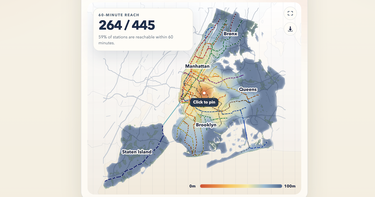
An interactive transit cartogram that warps New York City's map based on subway commute times from any origin point. Pin a location and explore how long it takes to reach different areas, with visual distortion showing transit accessibility.
What it can do
Pin a location as origin point
Geographic location in NYC → Selected origin point on map
Calculate subway commute times from origin
Origin location and destination areas → Commute time data for different areas
Generate transit time cartogram
Origin point and subway network data → Warped map showing time-based distances
Display visual map distortion
Commute time calculations → Geographically warped NYC map visualization
Show transit accessibility patterns
Subway commute data from origin → Visual representation of transit accessibility zones
Explore commute times to different areas
User interaction with map regions → Specific commute time information for selected areas
Why it made the leaderboard
Pin a spot in NYC and watch the map warp: neighborhoods pull closer or drift away based on real subway commute times from your origin. A cartogram that makes transit accessibility something you feel at a glance rather than compute.
Tags
Media
Comments (0)
No comments yet
Editorially curated, with community endorsements as a secondary signal. Corrections welcome.